ECLS Global, Inc. Mission
To provide high-quality Engineer Consulting & Land Surveying services with accuracy
and precision, driven by integrity and professionalism that is second to none.
Services
Surveying

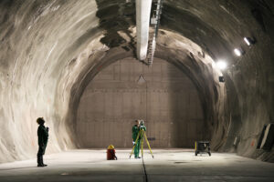
ECLS is a full service land surveying company with multiple licensed surveyors, field crews and CAD personnel. The types of services we routinely provide are listed below.
Residential
- Land Boundary & ALTA Surveys
- Mortgage Surveys
- Acreage Surveys
- Topographic Surveys
- Property Line Marking
- Tree Surveys
- Subdivisions
- Flod Elevation Certificates
- Plot Plans
- Construction Staking
- Foundation Surveys
Commercial
- Land Boundary & ALTA Surveys
- Acreage Surveys
- Topographic Surveys
- Volumetric Surveys
- Subdivisions
- Site Plans
- Construction Staking
- As-Built Surveys
Transportation
- Route Surveys
- Construction Staking
- As-Builts
Government: Federal, State & Local
- Land Boundary & ALTA Surveys
- Flood Elevation Certificates
- Construction Staking
- As-Built Surveys
Military
- Land Boundary & ALTA Surveys
- Site Plans
- Construction Staking
- As-Built Surveys
Civil Engineering

ECLS provides a range of civil engineering services to support land development projects. The types of services we have provided our clients are listed below.
Residential
- Land Planning / Feasibility Studies
- Zoning Assistance
- Grading Plans
- Road Design
- Water & Sewer Utility Design
- Stormwater Management Design
- Erosion & Sediment Control Plans
Commercial
- Land Planning / Feasibillity Studies
- Site Plans
- Zoning Assistance
- Grading Plans
- Road Design
- Water & Sewer Utility Design
- Stormwater Management Design
- Erosion & Sediment Control Plans
Transportation
- Road Design
- Stormwater Management Design
Government: Federal, State & Local
- Site Plans
- Land Planning / Feasibility Studies
- Zoning Assistance
- Grading Plans
- Road Design
- Water & Sewer Utility Design
- Stormwater Management Design
- Erosion & Sediment Control Plans
Military
- Site Plans
- Grading Plans
- Road Design
- Water & Sewer Utility Design
- Stormwater Management Design
- Erosion & Sediment Control Plans
Subsurface Utility Engineering

ECLS has employees experienced in locating locate undergound facilities such as utility lines which can be then mapped by ECLS surveyors. Such information is useful as engineers study what needs to be moved or avoided during the project planning and design process.
Residential
- Public & Private Utility Line Location
- Underground Utility Mapping
- Water, Sanitary Sewer and Stormwater Utility Design
Commercial
- Public & Private Utility Line Location
- Underground Utility Mapping
- Water, Sanitary Sewer and Stormwater Utility Design
Transportation
- Public & Private Utility Line Location
- Underground Utility Mapping
- Water, Sanitary Sewer and Stormwater Utility Design
Government: Federal, State & Local
- Public & Private Utility Line Location
- Underground Utility Mapping
- Water, Sanitary Sewer and Stormwater Utility Design
Military
- Public & Private Utility Line Location
- Underground Utility Mapping
- Water, Sanitary Sewer and Stormwater Utility Design
Hydrographic Surveying

ECLS can survey lands that are under rivers, lakes or the ocean. The types of hydrographic surveys we perform are as follows.
Residential
- Stormwater Pond Volume Studies
Commercial
- Stormwater Pond Volume Studies
Transportation
- Stormwater Pond Volume Studies
Government: Federal, State & Local
- Stormwater Pond Volume Surveys
- Hydrographic Survey Control Surveys
- Dredge Volume Surveys
Military
- Stormwater Pond Volume Studies
- Hydrographic Control Surveys
- Dredge Volume Surveys
